

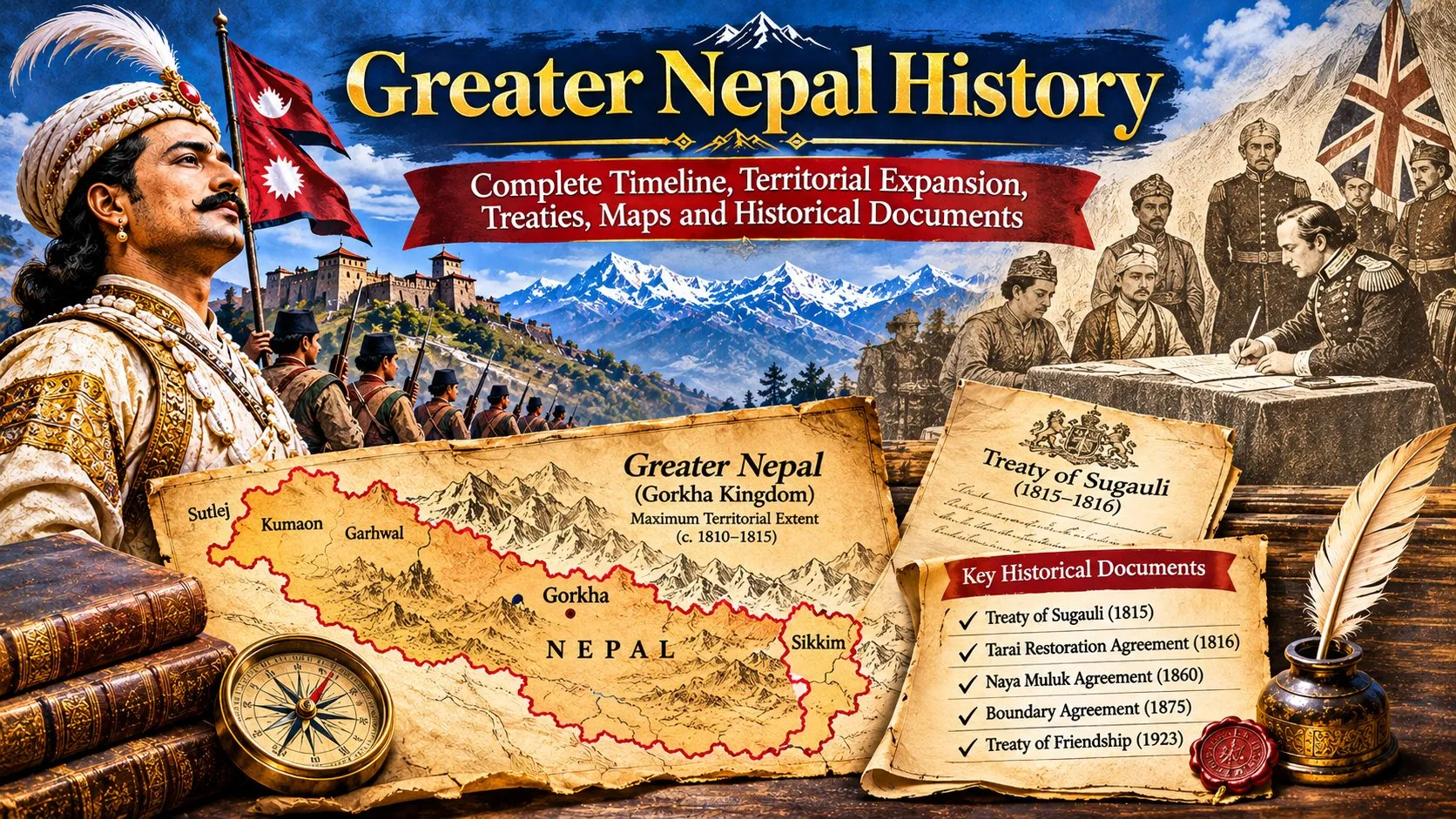
Greater Nepal History – Part 1: Before Unification, the Rise of Gorkha and Prithvi Narayan Shah's Campaigns
The history of Greater Nepal begins long before the Treaty of Sugauli and the territorial changes of the nineteenth century. To understand how the Gorkha Kingdom expanded across the Himalayan region, it is necessary to examine the political landscape of Nepal before unification, the rise of the Shah dynasty and the military campaigns led by Prithvi Narayan Shah.
During the eighteenth century, the region that forms present-day Nepal was divided among numerous kingdoms, principalities and local political authorities. The Gorkha state gradually expanded through warfare, diplomacy, alliances and political agreements. Its campaigns eventually brought the Kathmandu Valley under Shah rule and created the foundation for the larger Nepalese state.
1. Nepal Before Unification: A Region of Independent Kingdoms
Before the rise of Gorkha, the Himalayan region was not governed by a single central government. Different rulers controlled separate territories, each with its own political authority, military forces, economic interests and relationships with neighbouring states.
The Kathmandu Valley was one of the most important political and commercial centres. It contained three major Malla kingdoms: Kathmandu, Patan and Bhaktapur. Beyond the valley, the western hills contained numerous principalities, while eastern Nepal had distinct regional political traditions, including those associated with Limbuwan.
These kingdoms and principalities were connected through trade, religion, marriage alliances and political relationships. However, their rulers also competed for territory, revenue and influence. This fragmented political environment created opportunities for a rising power such as Gorkha to expand.
2. The Malla Kingdoms of Kathmandu, Patan and Bhaktapur
The Kathmandu Valley was historically an important centre of Newar civilization, trade, art, architecture and religious life. During the later Malla period, political authority was divided among three independent city-kingdoms.
Kathmandu Kingdom
Kathmandu, historically known as Kantipur, was ruled by the Malla dynasty. Its location and commercial connections made it an important centre of regional politics and trade. King Jayaprakash Malla was ruling Kathmandu when Gorkhali forces captured the city in 1768.
Patan Kingdom
Patan, also known as Lalitpur, developed its own royal court and political administration. It was an important centre of traditional craftsmanship, architecture, religious institutions and commerce. Political rivalry with Kathmandu and Bhaktapur weakened the ability of the three kingdoms to maintain a united defence.
Bhaktapur Kingdom
Bhaktapur, historically known as Bhadgaon, was another independent Malla kingdom. It remained an important political centre during the Gorkhali campaign and was captured in 1769, completing the conquest of the three principal Malla cities.
The rivalry among these kingdoms was an important factor in the success of Gorkha's expansion. Their political divisions made coordinated resistance difficult, although there were periods of cooperation against the Gorkhali forces.
3. The Baise and Chaubise Principalities
Outside the Kathmandu Valley, the western and central hills contained many smaller political states. Two commonly used historical groupings were the Baise Rajya and Chaubise Rajya.
Baise Rajya: The Twenty-Two Principalities
The Baise Rajya, traditionally described as the twenty-two principalities, were centred mainly around the Karnali and Bheri river regions in western Nepal. They included various small kingdoms and political territories, each with its own ruler and local authority.
These states did not always act as a single political alliance. Their rulers maintained changing relationships involving cooperation, rivalry and territorial disputes. Their fragmented political structure became relevant during the expansion of the Gorkha state.
Chaubise Rajya: The Twenty-Four Principalities
The Chaubise Rajya, traditionally described as the twenty-four principalities, were located mainly in the Gandaki region. These states included several hill kingdoms with their own military and political institutions.
Gorkha itself was part of this wider political environment. Its expansion therefore involved competition with neighbouring rulers rather than the conquest of a single unified western kingdom.
4. The Rise of the Shah Dynasty in Gorkha
The Shah dynasty became the central force behind the expansion of Gorkha. Dravya Shah is traditionally associated with the establishment of Shah rule in Gorkha in the sixteenth century. Over subsequent generations, the kingdom developed its own military and political ambitions.
Before Prithvi Narayan Shah became king, his father Narbhupal Shah had already attempted to expand Gorkha's influence towards Nuwakot. These earlier efforts were unsuccessful, but they demonstrated the strategic importance of controlling the territory between Gorkha and the Kathmandu Valley.
Prithvi Narayan Shah succeeded his father and became king of Gorkha in 1743. He transformed the kingdom's expansion ambitions into a sustained campaign that eventually brought the Kathmandu Valley and extensive surrounding territories under Shah authority.
5. The Conquest of Nuwakot in 1744
Nuwakot was one of the most strategically important locations in the early Gorkhali expansion. It overlooked routes connecting Gorkha with the Kathmandu Valley and the northern trade networks. Control of the area offered military and economic advantages.
Prithvi Narayan Shah's successful capture of Nuwakot in 1744 marked a major turning point. It provided Gorkha with a stronger position from which to challenge the Malla kingdoms and apply pressure on the Kathmandu Valley.
The conquest was not simply about acquiring a town. It was part of a wider strategy to control communication routes, trade and access to important political centres.
6. Prithvi Narayan Shah's Strategy for Unification
Prithvi Narayan Shah understood that conquering the Kathmandu Valley would require more than direct military attacks. His strategy combined military preparation, economic pressure, diplomacy and the exploitation of political rivalries among neighbouring rulers.
Gorkhali forces attempted to restrict the valley's access to important trade routes. Since the Malla kingdoms depended on regional commerce, pressure on trade and supplies created economic difficulties.
Prithvi Narayan Shah also used political relationships and negotiations to weaken opposition. The Malla rulers did not always cooperate effectively with one another, and Gorkha took advantage of their competing interests.
His military organization and methods of rewarding soldiers were also important. Historical studies describe the use of land assignments, known as jagirs, as part of the system used to support military service and motivate troops.
7. The Conquest of the Kathmandu Valley, 1768–1769
After years of military preparation and conflict, Gorkhali forces captured Kathmandu on 25 September 1768, during the Indra Jatra festival. Jayaprakash Malla fled, and Prithvi Narayan Shah established his authority in the city.
The capture of Kathmandu was a decisive moment in the formation of modern Nepal. The city became the political centre of the expanding Shah state.
Patan subsequently came under Gorkhali control, and Bhaktapur was captured in November 1769. With the conquest of the three Malla kingdoms, the political balance of the Kathmandu Valley changed permanently.
The conquest also brought the Gorkha state into possession of an important urban, commercial and administrative centre. The valley's established economic networks and political institutions became part of the expanding state.
8. What Happened After the Conquest?
The conquest of the Kathmandu Valley did not immediately complete the expansion of Nepal. Prithvi Narayan Shah and his successors continued campaigns in eastern and western regions, bringing additional territories under Gorkhali authority.
Prithvi Narayan Shah died in 1775. His successors continued the expansion, eventually extending Gorkhali power into territories associated with eastern Nepal, Kumaon, Garhwal and other Himalayan regions. These later campaigns form the subject of Part 2 of this historical series.
9. Historical Timeline: From Gorkha to the Conquest of the Kathmandu Valley
| Year or period | Historical event | Significance |
|---|---|---|
| Sixteenth century | Establishment of Shah rule in Gorkha under Dravya Shah | Foundation of the dynasty that later led the expansion. |
| Before 1743 | Narbhupal Shah's unsuccessful efforts towards Nuwakot | Demonstrated the strategic importance of the region. |
| 1743 | Prithvi Narayan Shah becomes king of Gorkha | Beginning of the central phase of Gorkhali expansion. |
| 1744 | Gorkhali conquest of Nuwakot | Provided a strategic base for further campaigns. |
| 1750s–1760s | Military and economic pressure on the Kathmandu Valley | Gradually weakened the Malla kingdoms. |
| 25 September 1768 | Gorkhali capture of Kathmandu | Established Shah authority in the capital. |
| 1768–1769 | Conquest of Patan and Bhaktapur | Ended the independent rule of the three Malla city-kingdoms. |
| 1775 | Death of Prithvi Narayan Shah | His successors continued the expansion of the state. |
10. Historical Sources and Further Reading
Researching Nepal's unification requires consulting both contemporary historical accounts and later scholarly studies. The following sources provide useful starting points for understanding the period covered in this part.
- John Whelpton, A History of Nepal: The Cambridge University Press chapter on unification discusses the Gorkhali campaigns, the Malla kingdoms and Prithvi Narayan Shah's political and military strategy. Read the chapter information.
- Francis Hamilton, An Account of the Kingdom of Nepal (1819): An early account based on Hamilton's fourteen-month stay in Nepal in 1802–1803, including observations and information gathered from local informants. View the digitized book at the Library of Congress.
- Ludwig F. Stiller, Modern Nepal: A historical study discussing the origins of modern Nepal and the military and political processes behind unification.
- Academic research on Nepal's state formation: Research on the pre-Rana period examines the distinction between nationalist descriptions of unification and the historical process of Gorkha's territorial expansion.
Conclusion
The foundation of modern Nepal was created through a long process of political and military expansion. Before unification, the region consisted of numerous independent kingdoms and principalities. The rise of the Shah dynasty in Gorkha, the leadership of Prithvi Narayan Shah and the conquest of the Kathmandu Valley transformed this fragmented political landscape.
However, the conquest of the valley was only the beginning of a wider expansion. The campaigns of Prithvi Narayan Shah's successors extended Gorkhali authority across the Himalayan region and eventually brought Nepal into conflict with Tibet, Qing China and the British East India Company.
Continue reading: Part 2 explores Gorkhali territorial expansion after Prithvi Narayan Shah, including the western Himalayan campaigns, the conquest of Kumaon and Garhwal, the Kangra campaign and Nepal's conflicts with Tibet and Qing China.
11. Gorkhali Territorial Expansion After Prithvi Narayan Shah
The death of Prithvi Narayan Shah in 1775 did not end the territorial expansion of the Gorkha Kingdom. Instead, his successors continued the process of bringing neighbouring Himalayan principalities under the authority of the expanding Nepalese state. During the following decades, Gorkhali military campaigns extended westward towards Kumaon, Garhwal and Kangra, while Nepal's northern ambitions brought it into conflict with Tibet and Qing China.
This period is central to understanding the historical concept of Greater Nepal. It was during the late eighteenth and early nineteenth centuries that Gorkhali authority extended across a much larger geographical region than the original Gorkha Kingdom. However, the nature of control differed between territories. Some were administered directly, while others experienced military occupation, negotiated political arrangements or contested authority.
12. Political Leadership After 1775
After Prithvi Narayan Shah's death, his son Pratap Singh Shah became king. His reign was relatively short, lasting from 1775 until 1777. Following his death, the young Rana Bahadur Shah inherited the throne, and political authority was exercised through regency arrangements.
Queen Rajendra Laxmi and later Bahadur Shah played important roles in governing the expanding kingdom. Bahadur Shah, a younger son of Prithvi Narayan Shah, became particularly influential during the period of western expansion.
Under these rulers and regents, the Gorkha state continued to strengthen its military organization, mobilize resources and pursue campaigns against neighbouring principalities.
Expansion was not simply the result of decisions made by the monarch. Military commanders, regional administrators, local allies and competing political factions also influenced the direction and outcome of campaigns.
13. Expansion into the Baise and Chaubise Principalities
After securing the Kathmandu Valley, the Gorkhali state continued its campaigns against the remaining hill principalities of central and western Nepal. These included territories traditionally associated with the Chaubise and Baise political groupings.
The Chaubise states were concentrated mainly in the Gandaki region, while the Baise principalities were associated with the Karnali and Bheri regions farther west.
Gorkhali expansion involved military campaigns, political agreements and changing alliances. Some rulers resisted, while others negotiated terms with the expanding state. The process was gradual and differed from one principality to another.
The incorporation of these territories increased the geographical reach of Nepal and provided additional manpower, agricultural resources and strategic routes for further campaigns.
However, the traditional labels Baise and Chaubise should not be interpreted as two fixed political federations with permanent boundaries. Their membership and political relationships changed over time.
14. Eastern Expansion and the Incorporation of Limbuwan
Eastern Nepal was another important region in the expansion of the Gorkha state. The eastern hills contained political territories associated with the Kirat communities, including Limbuwan, where local chiefs exercised authority under established political traditions.
Gorkhali campaigns reached eastern Nepal during the later years of Prithvi Narayan Shah's reign. The incorporation of Limbuwan is commonly associated with agreements concluded with local leaders in 1774.
These arrangements are significant because they illustrate that Gorkhali expansion was not always achieved through outright conquest alone. Negotiated relationships, recognition of certain local privileges and the continuation of existing institutions could also form part of the process.
Historical interpretations of these agreements differ, particularly concerning the rights of local chiefs and the extent of autonomy retained under Shah authority. Their precise terms should therefore be studied through Nepalese documentary records rather than simplified into a single account of military conquest.
15. The Conquest of Kumaon Around 1790
One of the most important stages of western expansion was the Gorkhali conquest of Kumaon, a Himalayan region now located in the Indian state of Uttarakhand.
Kumaon had its own political history under the Chand dynasty. During the late eighteenth century, internal political instability and regional conflicts weakened the kingdom.
Gorkhali forces advanced into Kumaon around 1790 and established authority over the region. Almora, an important political and administrative centre, came under Gorkhali control.
The conquest of Kumaon extended Nepal's western influence and provided a strategic position for further expansion into Garhwal.
Gorkhali administration in Kumaon involved the collection of revenue, maintenance of military authority and attempts to control important routes and settlements. Local resistance and political tensions continued during the period of Gorkhali rule.
Kumaon remained under Gorkhali control until the Anglo-Nepalese War, when British military campaigns ended Nepalese authority in the region in 1815.
16. The Conquest of Garhwal in 1804
After establishing control over Kumaon, Gorkhali military attention increasingly turned towards Garhwal. The Garhwal Kingdom was ruled by the Panwar dynasty and had experienced internal instability, political disputes and military pressures.
Gorkhali forces advanced into Garhwal and defeated the ruling power in 1804. King Pradyumna Shah was killed during the conflict, and Gorkhali authority was established over much of the kingdom.
The conquest extended Nepal's western frontier and brought the Gorkha state into control of a large Himalayan region with important mountain routes and settlements.
Gorkhali administration in Garhwal continued for approximately a decade, although the experience of local populations and the nature of political authority varied across the region.
The British East India Company's intervention during the Anglo-Nepalese War ultimately ended Gorkhali control over Garhwal.
17. The Kangra Campaign and the Limits of Western Expansion
Gorkhali ambitions did not stop at Garhwal. Military forces continued westward towards the Kangra region, an important political and strategic centre in the western Himalayas.
The Kangra campaign was associated with the military leadership of Amar Singh Thapa, one of the prominent commanders of the Gorkha state.
At the time, Kangra was ruled by Raja Sansar Chand, who faced conflicts with neighbouring powers. Gorkhali forces became involved in the region's political and military struggles.
However, the campaign faced strong resistance. Sansar Chand obtained assistance from Maharaja Ranjit Singh, the powerful Sikh ruler of Punjab.
In 1809, Sikh intervention forced the Gorkhali forces to withdraw from their advanced positions around Kangra. This marked a major limit to Gorkhali expansion towards the western Himalayas.
18. Nepal's Greatest Territorial Reach Before the Anglo-Nepalese War
By the early nineteenth century, the Gorkha state had expanded substantially from its original territory. Its authority extended across the Kathmandu Valley, much of present-day Nepal and western Himalayan territories including Kumaon and Garhwal.
Historical descriptions frequently associate the greatest western reach of Gorkhali expansion with the Sutlej River region and its eastern frontier with the Teesta River. However, these descriptions require careful interpretation.
The western campaigns reached the Kangra region, but the Gorkhali position there was contested and ultimately unsuccessful. Similarly, the political status of territories near the eastern frontier was shaped by changing relationships with Sikkim and neighbouring authorities.
For this reason, the maximum military reach of Gorkhali forces should not be confused with a continuously administered state extending uniformly between two rivers.
Different historical maps may show different boundaries depending on whether they depict military campaigns, territorial claims, administrative authority or the political situation at a particular date.
19. The First Nepal–Tibet War of 1788
While Gorkhali expansion continued in the Himalayan hills, Nepal's relations with Tibet became increasingly tense. Trade between Nepal and Tibet had long been important, especially through Himalayan routes connecting Kathmandu with Tibetan commercial centres.
Disputes arose over trade arrangements, currency and the treatment of Nepalese merchants. Nepalese silver coins had circulated in Tibet, and disagreements involving coinage and commercial obligations contributed to deteriorating relations.
In 1788, Gorkhali forces entered Tibet and occupied several frontier locations. The military campaign placed pressure on Tibetan authorities and led to negotiations.
A settlement was reached, commonly associated with the Treaty of Kerung. Historical accounts describe arrangements involving payments and the resolution of disputes, although the exact terms require comparison of surviving sources.
The settlement did not resolve all disagreements, and tensions continued between Nepal and Tibet.
20. The Second Nepal–Tibet War and Qing Intervention, 1791–1792
When the earlier arrangements broke down, Nepal launched another military campaign into Tibet in 1791. Gorkhali forces advanced towards important Tibetan centres, including Shigatse and the Tashilhunpo monastery area.
The campaign prompted intervention by the Qing Empire, which exercised political authority over Tibet and regarded the Nepalese advance as a challenge to its regional interests.
Qing forces launched a major military expedition across the Himalayan frontier. Their campaign pushed Gorkhali forces back towards Nepal and advanced into the region north of the Kathmandu Valley.
The conflict demonstrated that Nepal's military expansion faced powerful regional limits. The Qing Empire possessed considerably greater military resources, although mountainous terrain, supply difficulties and Gorkhali resistance complicated its campaign.
The Betrawati Settlement of 1792
The fighting ended through negotiations associated with the Betrawati region in 1792. The settlement established a new framework for relations between Nepal, Tibet and the Qing court.
Subsequent Nepalese diplomatic missions to China became an important feature of Nepal–Qing relations. Historians differ in how they interpret the political significance of these arrangements, particularly the distinction between Qing imperial diplomatic conventions and Nepal's internal political autonomy.
It would therefore be inaccurate to describe the settlement simply as either complete Nepalese independence from Qing influence or the permanent incorporation of Nepal into the Qing Empire.
The conflict is an important example of the interaction between military expansion, diplomacy and the political hierarchy of the Himalayan region.
21. The Political and Economic Consequences of Expansion
Gorkhali territorial expansion had major political, economic and social consequences. Bringing additional territories under Shah authority increased the state's access to revenue, agricultural land, trade routes and military manpower.
At the same time, maintaining control over distant territories created significant administrative and logistical challenges. Mountain geography made communication difficult, and local resistance complicated efforts to establish stable government.
Military campaigns also placed pressure on the state's financial resources. Soldiers required supplies, equipment and compensation, while newly acquired territories needed officials and systems for revenue collection.
These pressures became increasingly important as the Gorkha state came into contact with the British East India Company, whose territorial influence was expanding across northern India.
22. Historical Timeline of Gorkhali Expansion and Northern Conflicts
| Year | Event | Historical significance |
|---|---|---|
| 1774 | Political incorporation of Limbuwan | Eastern expansion and agreements with local authorities. |
| 1775 | Death of Prithvi Narayan Shah | Beginning of expansion under his successors. |
| 1777 | Rana Bahadur Shah becomes king | Regency politics shape the expanding state. |
| 1788 | First Nepal–Tibet War | Gorkhali campaign and settlement concerning Tibetan relations. |
| Around 1790 | Conquest of Kumaon | Major western territorial expansion. |
| 1791–1792 | Second Nepal–Tibet War | Qing military intervention in the Himalayan region. |
| 1792 | Betrawati settlement | New diplomatic relationship with Qing China. |
| 1804 | Conquest of Garhwal | Further western expansion. |
| 1809 | Kangra campaign ends in Gorkhali withdrawal | Major limit to expansion towards the western Himalayas. |
| 1814 | Beginning of the Anglo-Nepalese War | Military conflict with the British East India Company. |
23. Historical Documents and Research Sources
The period of Gorkhali expansion can be studied through Nepalese historical records, contemporary travel accounts, British diplomatic documents, Qing imperial records and later academic research.
- Francis Hamilton, An Account of the Kingdom of Nepal (1819): An early published account of the Gorkha state and its territorial expansion. Library of Congress.
- John Whelpton, A History of Nepal: A scholarly overview of Nepal's unification, political development and territorial expansion.
- Ludwig F. Stiller, The Rise of the House of Gorkha: A historical study of the expansion and development of the Gorkha state.
- Lei Lin, The Limits of Empire: The Qing-Gurkha War and China's Trans-Himalayan Frontier, 1788–1793: Academic research examining the conflicts between Nepal, Tibet and Qing China. Harvard University repository.
- Documenta Nepalica: A research resource for historical Nepalese manuscripts and documentary materials. Explore the collection.
- National Archives of Nepal: An institution holding important historical manuscripts and administrative records. Official website.
24. From Territorial Expansion to Conflict with British India
By the beginning of the nineteenth century, Nepal had become a significant Himalayan state. Its rulers had extended Gorkhali authority across a wide geographical area, but this expansion brought new political and military challenges.
The defeat of the western campaign around Kangra and the earlier conflict with Qing China demonstrated that further expansion faced powerful opposition. Meanwhile, British influence was increasing in northern India, creating new disputes over territory, trade and political authority.
As Gorkhali administration expanded towards the southern frontier, disagreements with the British East India Company intensified. Disputed areas such as Butwal and Sheoraj became important sources of tension.
These disputes eventually contributed to the outbreak of the Anglo-Nepalese War in 1814, a conflict that transformed Nepal's territorial history and led to the Treaty of Sugauli.
Next section: The Anglo-Nepalese War of 1814–1816, its causes, major battles, military commanders, the Treaty of Sugauli and the territorial consequences of the peace settlement.
25. The Anglo-Nepalese War (1814–1816): A Turning Point in Nepal's Territorial History
By the beginning of the nineteenth century, the Gorkha Kingdom had expanded across a large part of the Himalayan region. Its territories and military influence extended from the eastern frontier towards the western Himalayas, bringing Nepal into contact with the expanding British East India Company. The two powers increasingly competed over frontier territories, political influence and control of important routes.
The resulting Anglo-Nepalese War, fought between 1814 and 1816, fundamentally changed Nepal's territorial boundaries. Although Gorkhali forces demonstrated strong resistance in several battles, British military pressure eventually forced Nepal to accept the Treaty of Sugauli. The treaty became one of the most consequential agreements in Nepal's modern history.
26. Causes of the Anglo-Nepalese War
The war did not begin because of a single incident. It resulted from several years of territorial disputes, diplomatic disagreements and competition between two expanding political powers.
Territorial disputes in the Tarai
One of the immediate sources of conflict involved Butwal and Sheoraj, also written as Shivraj. These areas were important because of their agricultural production, revenue and strategic position along the southern frontier.
Nepalese authorities and the British East India Company disagreed over territorial authority, revenue collection and the rights of local rulers. The British also had interests connected with territories transferred by the Nawab of Oudh. The dispute became increasingly difficult to resolve through diplomacy.
Expansion of British influence
The East India Company had extended its political and military influence across much of northern India. Its interests included securing commercial routes, controlling frontier territories and preventing rival powers from challenging its regional position.
Nepal's western expansion into Kumaon and Garhwal brought the two powers into closer contact. British officials became concerned about the growing Gorkhali presence near territories under Company influence.
Failure of diplomatic negotiations
Both governments exchanged communications and attempted to settle frontier disagreements. However, the disputes over Butwal, Sheoraj and other areas remained unresolved. The British eventually issued demands that Nepalese authorities did not accept on the terms proposed.
On 1 November 1814, the Governor-General's declaration explaining the British decision to go to war was issued. The British Library preserves this declaration and related correspondence in its archival collection concerning the Nepal War.
Explore British Library record IOR/H/515: Papers concerning Nepal and the Nepal War, 1814–1816.
27. Beginning of the War in 1814
The British East India Company formally began military operations against Nepal in October 1814. British forces advanced along several routes, attempting to attack Gorkhali positions from different directions.
The British expected their numerical strength, military resources and access to supplies to provide an advantage. However, the mountainous terrain, fortified positions and determination of Gorkhali defenders made the campaigns more difficult than anticipated.
The conflict involved several separate military operations rather than one continuous battle. Important campaigns took place around Nalapani, Jaithak, Kumaon, Garhwal and other frontier positions.
28. Battle of Nalapani: The Resistance of Balbhadra Kunwar
The Battle of Nalapani, fought near Dehradun in 1814, became one of the best-known episodes of the Anglo-Nepalese War. Gorkhali forces under Balbhadra Kunwar defended the fortified position of Kalanga against a much larger British force.
British troops under Major-General Rollo Gillespie attempted to capture the fort through direct attacks. The Gorkhali defenders resisted repeated assaults, using their defensive position and knowledge of the surrounding terrain to their advantage.
Gillespie was killed during the fighting on 31 October 1814. British forces subsequently continued their attempts to capture the position, including the use of artillery and measures to cut off supplies and water.
Eventually, the defenders abandoned the fort after their position became increasingly difficult to sustain. Balbhadra Kunwar and surviving soldiers withdrew rather than surrendering to the British.
The resistance at Nalapani became an important part of Nepalese military history. British accounts also recorded the courage of the defenders, and the battle influenced later British perceptions of Gorkhali soldiers.
29. The Battle of Jaithak and the Western Campaign
Another important military position was Jaithak, located in the region of present-day Himachal Pradesh. Gorkhali forces defended the area against British operations during the war.
The campaign demonstrated that Gorkhali forces could use difficult terrain and fortified positions to resist a larger army. British forces faced logistical challenges, difficult roads and the need to maintain supplies across mountainous territory.
Although the British gradually gained ground, the fighting in the western region was not an immediate or effortless victory. The campaigns involved repeated engagements and changing military positions.
30. The Campaign in Kumaon and the Capture of Almora
British forces also advanced into Kumaon, which had been under Gorkhali control since the late eighteenth century. The campaign was strategically important because Kumaon formed part of Nepal's western territories and provided access to important Himalayan routes.
British commanders, including Colonel William Gardner and Colonel Jasper Nicolls, participated in operations against Gorkhali positions. The British captured Almora in April 1815, weakening Nepal's control over Kumaon.
The loss of Almora was a significant setback. It demonstrated that the British could defeat Gorkhali forces in strategically important mountain territories when they combined military pressure with logistical support and coordinated operations.
31. Amar Singh Thapa and the Defence of the Western Territories
One of the most prominent Nepalese commanders during the war was Bada Kaji Amar Singh Thapa. He had played an important role in the earlier expansion of Gorkhali authority and was responsible for defending important western positions.
British forces under General David Ochterlony advanced against Gorkhali positions in the western Himalayan region. Unlike some earlier British operations, Ochterlony's campaign made systematic use of artillery, supplies, engineering and coordinated advances.
After sustained military pressure, Amar Singh Thapa's position became increasingly difficult to maintain. The fall of important defensive positions weakened Nepal's western military position and contributed to the negotiations that followed.
Amar Singh Thapa's surrender at Malaun in May 1815 became an important turning point in the western campaign. His resistance remains significant in Nepalese military history.
32. The First Treaty Proposal and the Negotiations at Sugauli
By late 1815, British military successes had weakened Nepal's position. Negotiations began to establish peace and determine the territorial and diplomatic conditions under which the war would end.
The treaty was signed at Sugauli on 2 December 1815. Lieutenant-Colonel Paris Bradshaw represented the East India Company, while Nepalese representatives included Gajraj Mishra and Chandra Shekhar Upadhyaya.
However, signing the treaty did not immediately complete the peace process. Nepalese authorities did not deliver the ratification within the original period specified in the agreement. Political disagreements within the Nepalese court and continued resistance to the proposed terms delayed the final settlement.
The British subsequently continued military pressure, including an advance towards Makwanpur in February 1816. The renewed campaign strengthened the British negotiating position and contributed to Nepal's decision to complete the ratification process.
33. The Treaty of Sugauli: Signing and Ratification
The Treaty of Sugauli was signed on 2 December 1815 and ratified on 4 March 1816. The ratification was received at Makwanpur by the British representative, with Chandra Shekhar Upadhyaya acting as Nepal's agent.
The treaty consisted of nine articles. It established peace between the two powers, required territorial cessions, addressed Nepal's relationship with Sikkim, restricted the employment of certain foreign nationals and provided for diplomatic representatives at both courts.
The treaty was not simply a document defining a boundary. It also affected Nepal's diplomatic position and the relationship between its government and the British East India Company.
Read the transcribed Treaty of Sugauli.
34. The Nine Articles of the Treaty of Sugauli Explained
Article I: Peace and friendship
The first article established perpetual peace and friendship between the East India Company and the King of Nepal. It formally ended the state of war between the two powers.
Article II: Renunciation of disputed territorial claims
The second article required Nepal to renounce claims to lands that had been the subject of disputes between the two states before the war and acknowledge the Company's sovereignty over those lands.
Article III: Territorial cessions
The third article specified the territories Nepal ceded to the East India Company in perpetuity. It described lowland areas through the Kali, Rapti, Gandak, Koshi, Mechi and Teesta river boundaries and included specified hill territories east of the Mechi.
Article IV: Annual pensions
The fourth article provided for annual pensions totalling two lakh rupees for selected Nepalese chiefs and officeholders whose interests were affected by the territorial cessions. The beneficiaries were to be decided by the King of Nepal.
Article V: Territories west of the Kali River
The fifth article required Nepal to renounce claims to the countries west of the Kali River and to have no further involvement with those territories or their inhabitants.
Article VI: Nepal and Sikkim
The sixth article addressed Nepal's relationship with the Raja of Sikkim. Nepal agreed not to disturb the Raja in possession of his territories and accepted British arbitration in relevant disputes between the two sides.
Article VII: Employment of foreign nationals
The seventh article restricted Nepal from taking or retaining British subjects or subjects of European or American states in its service without British government consent.
Article VIII: Diplomatic representatives
The eighth article provided for accredited ministers from each side to reside at the court of the other, creating a formal diplomatic arrangement.
Article IX: Ratification
The ninth article established the ratification procedure. Nepal was required to ratify the treaty within fifteen days, while the British representative undertook to obtain and deliver the Governor-General's ratification.
35. Territorial Consequences of the Treaty of Sugauli
The territorial provisions of the treaty significantly reduced the geographical extent of Nepal. The consequences were particularly important in the western Himalayas, the southern Tarai and the eastern frontier.
Among the major territorial changes were:
- Kumaon: Nepal lost its control over the region following British military operations and the post-war settlement.
- Garhwal: Gorkhali authority over much of the region ended during the war.
- Western territories: Article V renounced Nepalese claims to territories west of the Kali River.
- Tarai areas: Article III specified several lowland territories that were ceded to the Company.
- Eastern territories: The treaty included territories between the Mechi and Teesta and specified areas east of the Mechi.
The treaty's language is important because it describes territories using rivers, lowlands and geographical references rather than a modern list of districts. Researchers should consult the complete text and historical maps before assigning modern administrative names to the areas concerned.
36. How the Treaty Changed Nepal's Political Position
The Treaty of Sugauli affected more than the size of Nepal. It altered the balance of power between Nepal and the British East India Company and restricted aspects of Nepal's foreign relations.
The provision concerning Sikkim gave the British an important role in disputes between Nepal and the neighbouring kingdom. The restriction on employing certain foreign nationals also limited Nepal's freedom to engage European and American personnel without British consent.
The provision for accredited ministers created a formal diplomatic relationship, but it also reflected the unequal position of the two powers after the war.
Nevertheless, Nepal retained its monarchy, internal government and separate political identity. The treaty did not convert Nepal into a directly administered British colony.
37. Timeline of the Anglo-Nepalese War and the Treaty
| Date | Event | Significance |
|---|---|---|
| 1 November 1814 | British declaration explaining the causes of war | Formal statement of the British position. |
| October 1814 | British military operations begin | Start of the Anglo-Nepalese War. |
| 31 October 1814 | Battle of Nalapani | Major Gorkhali resistance; General Gillespie killed. |
| 1814–1815 | Jaithak and western campaigns | Repeated fighting across Himalayan positions. |
| April 1815 | British capture of Almora | Loss of Gorkhali control over Kumaon. |
| May 1815 | Amar Singh Thapa surrenders at Malaun | Major setback in the western campaign. |
| 2 December 1815 | Treaty of Sugauli signed | Agreement establishing the post-war settlement. |
| February 1816 | British advance towards Makwanpur | Renewed military pressure on Nepal. |
| 4 March 1816 | Treaty ratification received at Makwanpur | Completion of the formal ratification process. |
38. Historical Records of the Anglo-Nepalese War
Several important archival and published sources preserve evidence of the war and the treaty negotiations. These are particularly valuable because they allow researchers to examine how the conflict developed from the perspectives of the British authorities and later historians.
- British Library, IOR/H/515: Contains a memorandum on the origin and progress of the war, treaty negotiations, comparisons between proposed and final treaty terms, the British declaration of war and correspondence concerning disputed territories. View the archival catalogue.
- British Library, IOR/H/644: A further archival collection concerning the Nepal War of 1814–1816. View the catalogue.
- Government of Nepal's Institute of Foreign Affairs: Its publication 200 Years of Nepal-Britain Relations: A Way Forward discusses the history of bilateral relations and the treaty. Read the publication.
- Ritesh Kumar Shah: The Anglo-Gorkha Wars: Campaigns from Kali to Sutlej, a research paper examining the military campaigns of 1814–1816. Read the paper.
- Treaty of Sugauli transcription: Read the nine articles and ratification text.
39. Conclusion: A Turning Point in Nepal's Territorial History
The Anglo-Nepalese War of 1814–1816 marked a major turning point in the history of Nepal. The conflict exposed the limits of Gorkhali military expansion and brought Nepal into a new political relationship with the British East India Company.
The Treaty of Sugauli changed Nepal's territorial boundaries, ended its control over important western Himalayan territories and introduced new restrictions and diplomatic arrangements. Its consequences continued to influence Nepal's political and geographical development throughout the nineteenth century.
However, the treaty was not the final stage in the formation of Nepal's modern boundaries. Subsequent agreements in 1816 and the territorial restoration of 1860 further changed the country's southern and western frontiers.
Continue to the next section: The next part examines the 1816 restoration of Tarai territories, the Nepal–Tibet settlement, Naya Muluk in 1860, the 1923 Treaty of Friendship, historical maps, archival documents and the modern Greater Nepal debate.
Territorial Restorations, Historical Documents, Maps and the Modern Greater Nepal Debate
The Treaty of Sugauli in 1816 marked a major turning point in Nepal’s territorial history, but it did not end the process of negotiating borders and adjusting territory. In the decades that followed, Nepal entered into additional agreements with British India and Tibet. Some territories were restored, new boundaries were defined, and diplomatic relations gradually developed through a series of treaties and engagements.
Understanding this period requires looking beyond the Treaty of Sugauli. The restoration of parts of the Tarai in 1816, the Nepal–Tibet Treaty of 1856, the return of the western Tarai in 1860 and the Treaty of Friendship of 1923 each represent different stages in Nepal’s political and territorial history.
1. The Restoration of the Tarai in 1816
Following the Anglo-Nepalese War, the Treaty of Sugauli required Nepal to surrender extensive territories to the British East India Company. However, the territorial settlement was subsequently adjusted. On 8 December 1816, the British Government presented a memorandum proposing the restoration of significant Tarai lands to Nepal. The Nepalese ruler accepted the terms through documents dated 11 December 1816.
The arrangement concerned Tarai territories between the rivers identified in the historical documents as the Coosa, Gunduck and Rapti. These names are historical spellings generally associated with the Koshi, Gandak and Rapti rivers. The restoration was not unconditional: disputed lands, certain privately held properties and areas required for boundary adjustments were treated as exceptions.
The documents are important because they show that the territorial settlement following the war was not limited to the original Treaty of Sugauli. The 1816 restoration was a separate arrangement involving a British memorandum, a letter from the Nepalese ruler and a document bearing the seal of the Nepalese Darbar.
The historical treaty compilation A Collection of Treaties, Engagements and Sanads Relating to India and Neighbouring Countries lists the restoration agreement and the related Nepalese correspondence separately. This makes it a useful starting point for studying the legal and documentary sequence.
2. Nepal–Tibet Treaty of 1856
Another important chapter in Nepal’s territorial and diplomatic history concerns its relationship with Tibet. Following the Nepal–Tibet conflict of 1855–1856, the two sides concluded a peace treaty in March 1856, commonly known as the Treaty of Thapathali.
The agreement addressed several matters, including annual payments from Tibet to Nepal, trade and customs arrangements, military withdrawal, prisoners and the treatment of people and merchants from both sides. It also contained provisions concerning mutual assistance and the handling of disputes involving subjects of the two governments.
The treaty is particularly significant because it demonstrates that Nepal’s international relations were not limited to its southern frontier with British India. Nepal also maintained a distinct diplomatic relationship with Tibet, involving trade, security, political influence and cross-border administration.
Different historical translations of the treaty exist. For example, the Nepalese and Tibetan versions and later English translations may differ in wording. Therefore, researchers should identify which version they are quoting instead of treating every published translation as identical.
One accessible translation is available in the historical collection Nepal, Volume II, by Perceval Landon. Another published translation is available through the Political Treaties of Tibet collection.
3. The Return of Naya Muluk in 1860
One of the most important territorial developments after the Anglo-Nepalese War took place in 1860. Nepal had supported the British during the Indian Rebellion of 1857. During the subsequent period of improved relations, the British Government agreed to transfer certain western Tarai territories to Nepal.
The territories became known as Naya Muluk, meaning “new country” or “new territory.” They are associated with the present-day districts of Banke, Bardiya, Kailali and Kanchanpur.
The Treaty of 1 November 1860 formally provided for the transfer of the lowlands between the Kali and Rapti rivers and other specified territories. Its provisions described the transfer as a grant in full sovereignty to the Maharaja of Nepal. The treaty also addressed the boundary line and the marking of the transferred territory.
It is important to distinguish the date of the treaty from later administrative and boundary steps. The treaty was signed at Kathmandu on 1 November 1860, while its ratification is recorded as taking place on 15 November 1860. Some historical boundary references use the latter date when discussing the boundary settlement.
| Territory | Present-day district | Historical significance |
|---|---|---|
| Banke | Banke District | Part of the western Tarai territory transferred to Nepal |
| Bardiya | Bardiya District | Part of the territory commonly associated with Naya Muluk |
| Kailali | Kailali District | Part of the western Tarai restoration |
| Kanchanpur | Kanchanpur District | Part of the territory transferred to Nepal in 1860 |
The 1860 settlement is significant because it shows that Nepal’s post-Sugauli territorial history included both losses and later recoveries. However, the restoration should be understood through the specific terms of the treaty rather than through broad claims that all territories lost in the Anglo-Nepalese War were returned.
The text of the 1860 treaty can be consulted through this published transcription of the boundary treaty. Researchers should compare transcriptions with authoritative treaty compilations where possible.
4. Other Important Nepalese Treaties and Agreements
Nepal’s diplomatic history continued through several additional agreements. These documents dealt with matters such as extradition, border administration, criminal investigations and relations with neighbouring governments. They are important because they show how the relationship between Nepal and British India developed beyond the territorial settlement of 1816.
| Date | Agreement or document | Main subject |
|---|---|---|
| 8 December 1816 | Tarai Restoration Agreement | Restoration of specified Tarai territories |
| 10 February 1855 | Treaty concerning extradition of criminals | Extradition and legal cooperation |
| 24 March 1856 | Nepal–Tibet Treaty | Peace, trade, payments and relations between Nepal and Tibet |
| 1 November 1860 | Treaty of Territorial Rewards | Transfer of specified western Tarai territories to Nepal |
| 23 July 1866 | Supplemental Treaty | Further provisions concerning the surrender of criminals |
| 7 January 1875 | Boundary Agreement | Definition of boundaries of transferred territory |
| 24 June 1881 | Further Supplemental Treaty | Additional provisions concerning extradition |
| 21 December 1923 | Treaty of Friendship | Recognition of mutual independence and continued diplomatic relations |
This list is a selection of important instruments, not a complete register of every agreement involving Nepal. The dates and titles follow the treaty compilation commonly known as Aitchison’s collection. The compilation is valuable for locating historical documents, but researchers should consult the individual texts and their archival records before making detailed legal or historical interpretations.
5. The Treaty of Friendship of 1923
The Treaty of Friendship between Nepal and Great Britain was signed at Kathmandu on 21 December 1923. It was a major diplomatic milestone because the two governments expressly agreed to acknowledge and respect each other’s independence, both internal and external.
The treaty also confirmed earlier treaties, agreements and engagements between the two governments, except where the 1923 agreement altered them. Its provisions addressed peaceful relations, consultation over serious disagreements with neighbouring states and measures to prevent either country’s territory from being used against the security of the other.
The treaty included a related note concerning the importation of arms and ammunition into Nepal. Ratifications were exchanged at Kathmandu on 8 April 1925.
The 1923 agreement is often discussed as an important step in the formal diplomatic recognition of Nepal’s independence by Britain. However, it should not be described as the moment Nepal first became independent in every historical or political sense. Nepal had maintained its own monarchy, government and international relations long before 1923. The treaty gave a clearer formal expression to the mutual recognition of independence between the two governments.
The treaty text is reproduced in historical treaty collections and can also be consulted through this published transcription of the 1923 Treaty.
6. How to Study Original Historical Documents
Research into Nepal’s territorial history requires careful examination of primary sources. A treaty transcription, an archival catalogue entry, a historical map and an original signed document are not the same thing. Each provides a different kind of evidence.
- Original treaty: The actual historical document, ideally with signatures, seals, dates and other identifying features.
- Published transcription: A printed or digital reproduction of the document’s wording. It may contain spelling differences, editorial changes or translation choices.
- Archival catalogue: A record describing a document or collection held by an archive. It helps researchers locate material but is not itself the original document.
- Historical map: A visual representation of territory, boundaries, routes or claims at a particular time. Its date, creator, purpose and geographical accuracy must be examined.
- Secondary scholarship: Historical analysis by researchers who interpret primary evidence and compare different accounts.
Several institutions and collections are useful for further research:
- National Archives of Nepal – an important starting point for identifying Nepalese archival holdings.
- Documenta Nepalica – a research resource containing digitised historical documents and related scholarly information.
- British Library: IOR/H/515 – a catalogue record relating to papers concerning Nepal, including material on the Nepal War of 1814–1816.
- British Library: IOR/H/644 – another archival catalogue record relevant to historical research.
- Aitchison’s treaty compilation – a published collection of treaties and engagements relating to Nepal and neighbouring countries.
When using these materials, researchers should record the document title, date, archive reference, language, version and page number. If a document is a translation, the translator and source language should also be identified. This makes historical claims easier to verify and prevents a modern transcription from being incorrectly presented as an original signed document.
7. Understanding Historical Maps and Territorial Claims
Historical maps are essential for understanding the expansion and contraction of Nepal’s territory. However, maps must be interpreted carefully. A map showing the farthest reach of a military campaign does not necessarily demonstrate that the territory was permanently administered by Nepal. Similarly, a map showing a ruler’s claim does not automatically establish internationally recognised sovereignty.
For a reliable historical map collection, each map should ideally include its publication date, author or institution, scale, geographical coverage and the purpose for which it was produced. Maps created during the eighteenth and nineteenth centuries may use different place names, spellings and surveying methods from modern maps.
Researchers should also distinguish between areas under direct administration, territories controlled through subordinate rulers, tributary relationships, temporary military occupation and disputed frontier zones. These categories are not interchangeable. A single map that colours all such areas identically may give readers an inaccurate impression of the political situation.
8. The Modern Greater Nepal Debate
The term “Greater Nepal” is used in contemporary discussions about the historical extent of Nepal before and around the Anglo-Nepalese War. The debate often focuses on territories that came under Gorkhali control during the expansion of the Shah kingdom and were subsequently ceded or otherwise affected by the Treaty of Sugauli and later agreements.
For historical research, it is legitimate to examine the extent of Gorkhali expansion, the circumstances of territorial losses, the wording of treaties and the later restoration of particular areas. These are important subjects in Nepal’s history and deserve careful documentary study.
However, historical territorial control and present-day international boundaries are separate questions. The existence of an earlier military campaign, historical claim or administrative relationship does not by itself establish a present-day legal entitlement to territory. Any contemporary territorial argument must be assessed under the relevant treaties, subsequent state practice, international law and the current positions of the governments concerned.
It is therefore important to distinguish three things: the historical extent of the Gorkha state, the territories addressed by nineteenth-century treaties, and the present internationally recognised territory of Nepal. Treating these as identical can lead to misleading conclusions.
9. Conclusion: A Documentary Approach to Nepal’s Territorial History
Nepal’s territorial history cannot be understood through one treaty or one historical map. The expansion of the Gorkha kingdom, the conflicts with Tibet and Qing China, the Anglo-Nepalese War, the Treaty of Sugauli, the restoration of parts of the Tarai, the return of Naya Muluk and the Treaty of Friendship of 1923 form interconnected but distinct chapters.
The agreements of 1816 and 1860 demonstrate that territorial arrangements continued to change after the Anglo-Nepalese War. The Nepal–Tibet Treaty of 1856 illustrates another dimension of Nepal’s diplomacy, while the 1923 treaty provides important evidence of the formal recognition of mutual independence between Nepal and Britain.
A responsible history of Greater Nepal should present the original wording of treaties where available, identify the source and date of each map, distinguish confirmed facts from disputed interpretations and avoid treating temporary military control as permanent sovereignty. It should also separate historical research from modern political claims.
By bringing together treaty texts, archival records, historical maps and scholarly research, readers can develop a more accurate understanding of how Nepal’s territory evolved and how its modern borders took shape.
Selected Historical References and Further Reading
- C. U. Aitchison, A Collection of Treaties, Engagements and Sanads Relating to India and Neighbouring Countries, Nepal section.
- Perceval Landon, Nepal, Volume II, including the published text of the 1856 Nepal–Tibet Treaty.
- John Whelpton, A History of Nepal, Cambridge University Press.
- British Library India Office Records, including IOR/H/515 and related Nepal records.
- National Archives of Nepal, historical archival collections.
- Documenta Nepalica, digitised historical documents and research resources.
- Treaty of Friendship between Great Britain and Nepal, signed 21 December 1923.
- Treaty between the British Government and Nepal concerning territorial rewards, signed 1 November 1860.
Editorial note: This article is a historical overview and selected documentary guide. It is not a complete transcription of every Nepalese treaty, boundary record or archival document. Dates and treaty descriptions should be checked against the relevant original or authoritative published version when used for legal, academic or archival purposes.


Comments
Sign in to leave a comment.
Sign in